With the arrival of 2.7, some like to carry out IFR approaches since the weather conditions are much more realistic and we can now have the chance to land our dear planes in shitty weather!
Airport approach charts based on reality and adapted to the DCS universe.
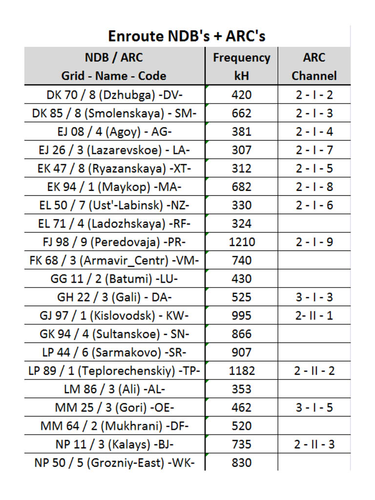
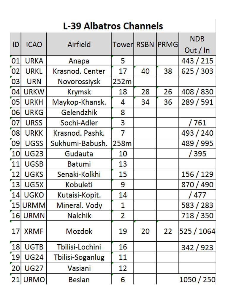
Approach headings, NDB, VOR, VORTAC, TACAN, ILS beacons, frequencies, heading, altitudes, GPS coordinates are checked and corrected to match the DCS universe!
I adapted the existing real approach maps to the game by adapting them (modified the paterns and the runway angles which are those of DCS) and they are readable in VR.
I also used the real maps for the car parks to be closer to reality. Other airports are in the works and I will update the file. New airports to come within 1 or 2 months for the SYRIA map. Approach charts available for Syrian, Marianas, Persian Gulf, and South Atlantic theaters.
I wish you all good use !
Comentaries are welcome !


 approach, IMC (Hard)")


")
