DCS: South Atlantic
Available now in Open Beta
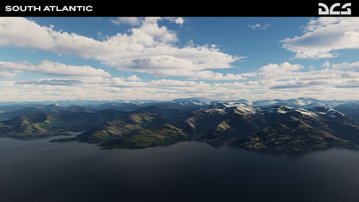
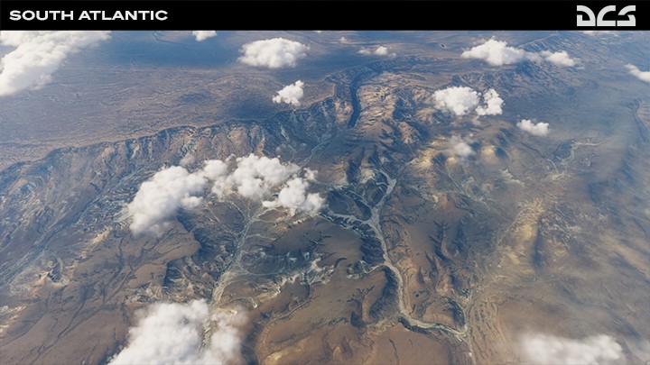
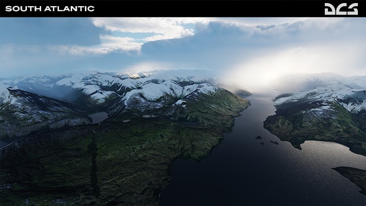
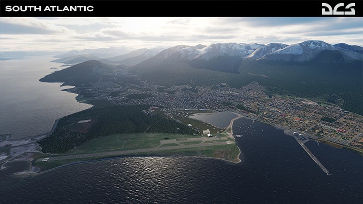
The RAZBAM Terrain Development Team is proud to present the South Atlantic map that is a beautiful and majestic combination of Argentina, Chile, and the Falkland/Malvinas Islands. The topography of the region includes the beautifully rugged mountains of Chile, the vast and colorful Patagonian plains of Argentina, and the windswept islands of West and East Falklands/Malvinas. Covering an area of 3.1 million square kilometers, the team’s goal has been to give the DCS community the opportunity to develop missions that reflect the scale and complexity of modern-day operations in this scenic region.
|
Early Access Program
DCS: South Atlantic
Available for a limited time at only $55.99
Download ›
|
When developing this map, the team was proactive in listening to the DCS community regarding both scale and requirements of modern-day military operations. This provides the best possible experience and leverages land-class textures drawn from aerial and satellite photography.
Development of the South Atlantic map will continue, and the team is now moving their focus from the Falkland/Malvinas Islands to mainland Argentina and Chile. They will flesh out the rural areas of the map to provide a more authentic and lived-in look. This will include adding additional buildings, infrastructure, and tidying up vector data (like mountains). Our community's input pushed for the inclusion of mainland and the team dedicated to make it even better.
Moving forward, additional airfields will be added throughout the map to provide a diversified area of Naval and Fighter operations. The goal is to include all airfields at a high quality level. More villages, settlements, and road infrastructure improvements will be added across the various regions.
The following items will also be further improved during the early access period:
- Visible tiling around some airfields and at certain view angles
- Some angular sea cliffs
- Forest tiling from some view angles
The DCS: South Atlantic map has undertaken a new strategy for generating terrain. Whereas all other DCS maps rely heavily on art-created ground textures combined with satellite textures, the South Atlantic map relies mostly on satellite textures. While this results in a more realistic looking map at medium to high altitudes, ground textures may appear less defined at low altitude. The team is committed to further improving the low-altitude terrain textures.
|