


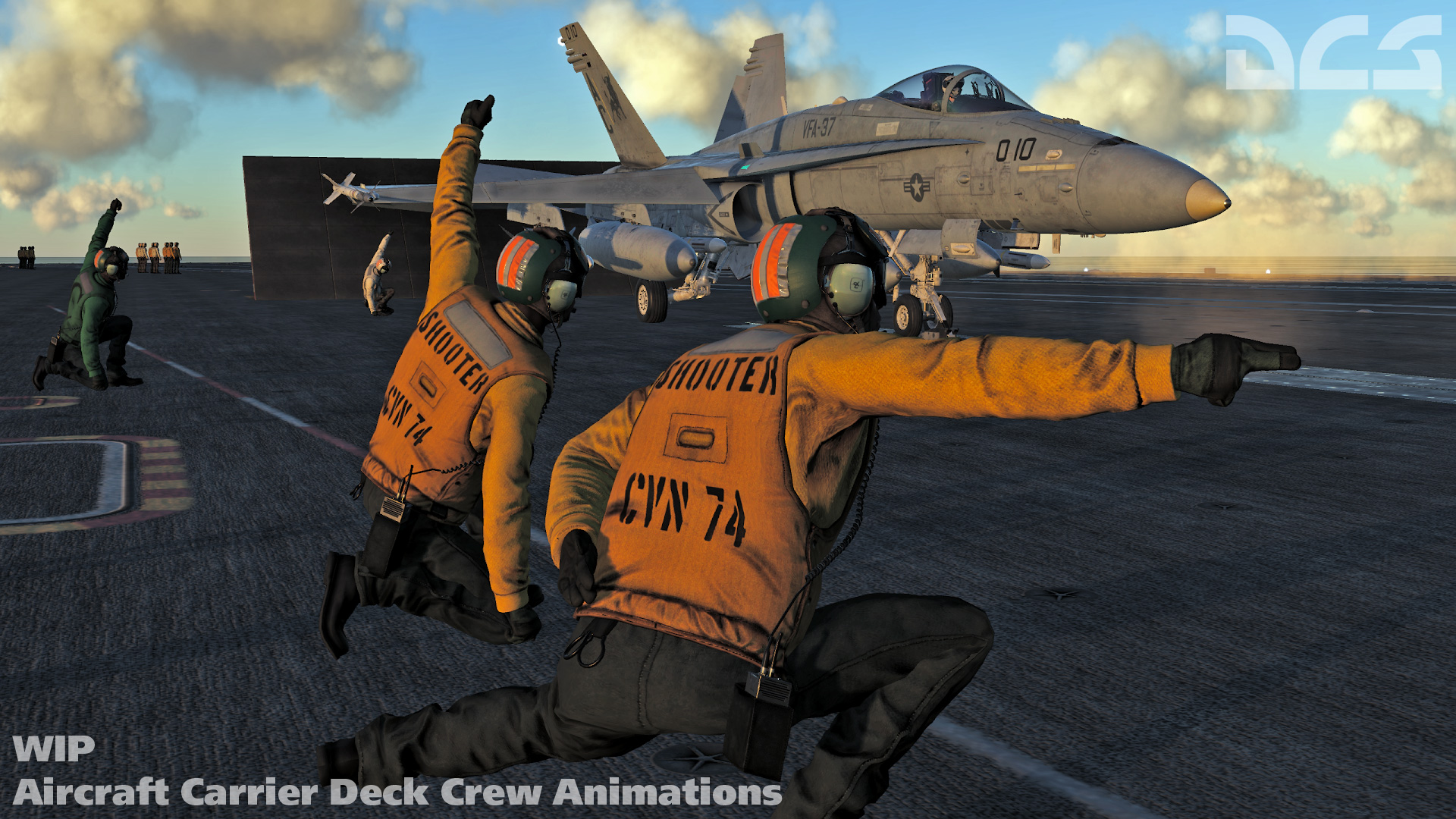
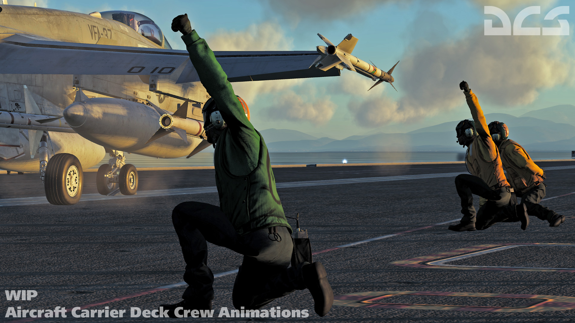
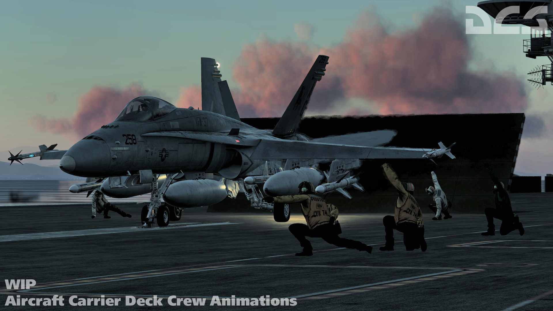
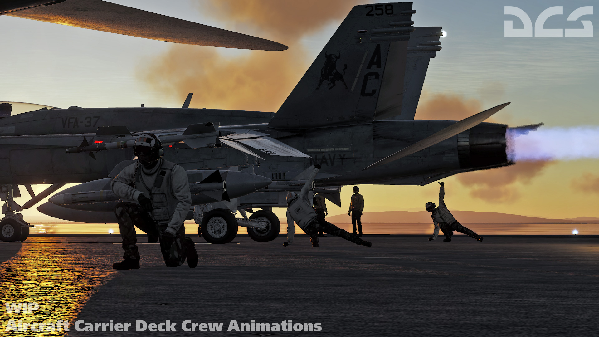
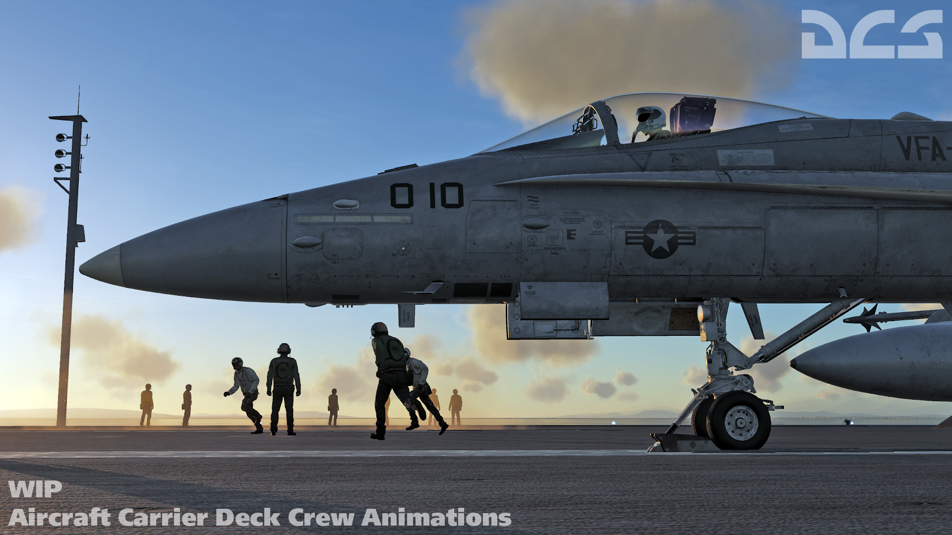
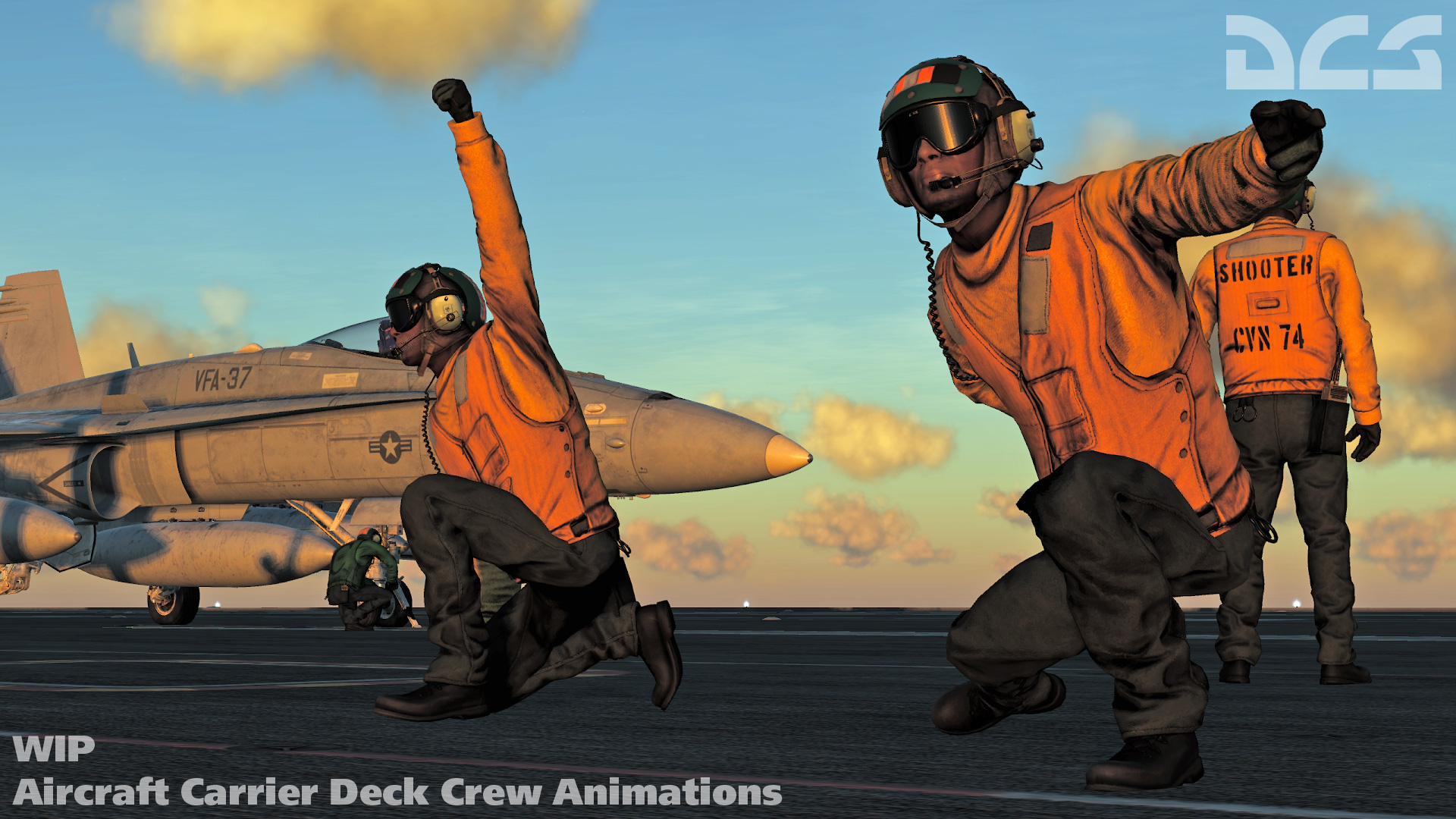
Aircraft Carrier Deck Crew Animations
A key aspect of creating the new Nimitz-class aircraft carrier module is the inclusion of animated deck crew. These are particularly vital for launch operations from the bow and waist catapults. This includes yellow shirt plane directors, green shirt catapult crew, red shirt weapons crews, etc. Between the animated deck crew, advanced carrier radio communications, and a highly detailed carrier model, we are striving to create the most detailed and accurate carrier environment ever done for the PC.
Also, to update you on how we will handle the new carrier in network play, the new carrier will appear in network missions, even if you do not own the Nimitz-class aircraft carrier module. As such, even if you do not own the module, you can still join missions that include it. However, if you do not own this carrier module, you will be unable to start from this carrier, land on it, or experience the deck crew and radio communications.
 |
 |
 |
 |
 |
 |
F-16C Audio
A very important aspect of developing the most realistic F-16C simulation possible will be the audio environment. This includes all the sounds within the cockpit like voices messages and beeps and boops, but also the external engine sounds, fly-by sounds, and all the other sounds that make an F-16C sounds like an F-16C.
In this video we have a sample of the new audio technology recently developed that or Viper takes advantage of.
Free Normandy Map Update Coming
In May 2017, Urga Media released their DCS: Normandy 1944 map for DCS World. The map focused on the landing beaches of Normandy and points south to encompass the breakout period in June 1944. The entire map also includes portions of southern England and areas outside the landing and breakout area to the south at a lower level of detail. The total map size is 267 x 348 kilometers and includes many period specific buildings, bridges, vehicles, windmills, and other objects that populate the map. This has been the ideal map for World War II combat and even low-altitude helicopter flying.
Since the release and a large update to this map, Urga Media has been very busy to two primary items: The DCS: Syria map and another large, free, update to the Normandy map!
This free Normandy map will include the following:
- Improved quality of ground textures (fields and urban areas).
- Improved quality of the noise textures. This will be particularly evident at low altitudes.
- Improved quality of the coastline, both in Normandy and along the English coast.
- Processing of fields and city vector data to use new DCS World terrain technologies.
- Improved quality of the rivers and lakes.
- Improved quality of roads.
- Increased the number of unique objects and scenes.
- Optimization and improved the look of the trees and forests.
- Optimization of map for virtual reality performance.
We have no planned release date at this time.
DCS World Open Beta News
This week’s Open Beta is a continuation of last week’s Open Beta to address some items that we were unable to address last week. Highlights include:
- DCS World: Added support for 1024x1024 briefing images, corrected mission editor altitude display, adjusted shadows of objects as seen from the cockpit, corrected client missiles going underground in network play, and further optimized the dedicated server performance.
- F/A-18C Hornet: Added AGM-154A JSOW, fixed incorrect TD box movement on HUD in LTWS mode, added Multi-Sensor Integration (MSI) mode for Latent Track While Scan (LTWS) radar sub-mode, added BRU-55A/A dual smart weapon rack, and corrected LOFT mode for the AIM-7.
- Fw 190 A-8: Corrected training missions, airspeed indicator, idle engine sound, and gun sight alignment.
- Yak-52: Added new flap failure sounds.
Please read the complete change log here.
Sincerely,
The Eagle Dynamics Team