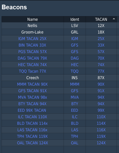
A simple PNG image with a list of TACAN stations, VORTAC freqs, and ILS localizer's for the DCS NTTR map. This was taken directly from the game files and should not be used for real world navigation. (obviously).
Drop this image into the kneeboard for any aircraft you'd like and you'll be able to bring it up as needed when flying on the Nevada map in DCS.
Feel free to message me or comment if you'd like a specific image like this made and I'll do what I can. (it's possible to exclude or include differant types of data to make this image, for example only RSBN stations, or NBD's, etc)
I hope this is useful, and I'll see you in the skies.


